Technology would use drones and insect biobots to map disaster areas
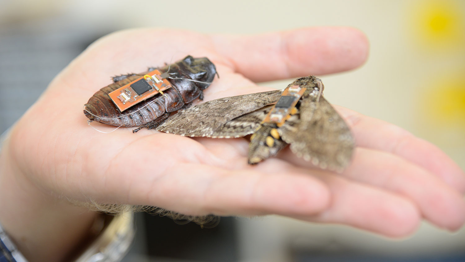
Insect cyborgs, or biobots, may one day team with unmanned aerial vehicles (UAVS) to map disaster areas using technology being developed at NC State.
“The idea would be to release a swarm of sensor-equipped biobots — such as remotely controlled cockroaches — into a collapsed building or other dangerous, unmapped area,” says Dr. Edgar Lobaton, an assistant professor of electrical and computer engineering and co-author of two papers describing the work.
“Using remote-control technology, we would restrict the movement of the biobots to a defined area,” Lobaton says. “That area would be defined by proximity to a beacon on a UAV. For example, the biobots may be prevented from going more than 20 meters from the UAV.”
The biobots would be allowed to move freely within a defined area and would signal researchers via radio waves whenever they got close to each other. Custom software would then use an algorithm to translate the biobot sensor data into a rough map of the unknown environment.
Once the program receives enough data to map the defined area, the UAV moves forward to hover over an adjacent, unexplored section. The biobots move with it, and the mapping process is repeated. The software program then stitches the new map to the previous one. This can be repeated until the entire region or structure has been defined, providing a map that could then be used by first responders or other authorities.
“This has utility for areas where GPS can’t be used,” Lobaton says. “A strong radio signal from the UAV could penetrate to a certain extent into a collapsed building, keeping the biobot swarm contained. And as long as we can get a signal from any part of the swarm, we are able to retrieve data on what the rest of the swarm is doing.”
Return to contents or download the Spring/Summer 2017 NC State Engineering magazine (PDF, 3.7MB).
- Categories: